Digital Photogrammetry

Digital Photogrammetry is a remote sensing technology that uses overlapping images taken from different angles to create 2D and 3D models of objects, scenes, and environments.

Here’s a simplified overview of the digital photogrammetry process:

  • Image Acquisition: Overlapping images are taken from different angles using cameras or other imaging sensors.
  • Image Processing: The images are processed to enhance quality, remove noise, and correct for distortions.
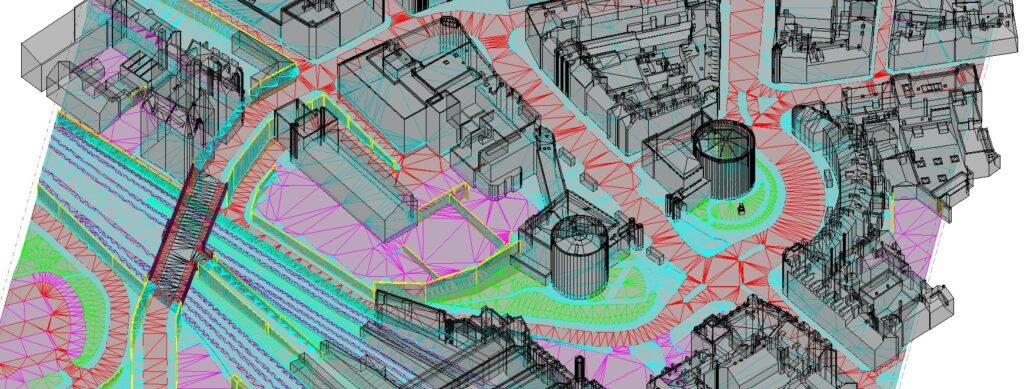
  • Feature Extraction: Distinctive features such as points, lines, and shapes are extracted from the images.
  • Matching and Triangulation: The extracted features are matched across multiple images, and their 3D coordinates are calculated using triangulation techniques.
  • 3D Model Creation: The 3D coordinates are used to create a 3D model of the object, scene, or environment.

Digital Photogrammetry has a wide range of applications, including:

  •  Aerial Mapping: Creating detailed 2D and 3D maps of urban and rural areas.
  • Architecture: Creating detailed 3D models of buildings and structures.
  • Engineering: Creating detailed 3D models of infrastructure, such as roads, bridges, and tunnels.
  • Film and Gaming: Creating detailed 3D models of objects and environments for visual effects and game development.
  • Forensic Science: Creating detailed 3D models of crime scenes and accident sites.
  • Heritage Preservation: Creating detailed 3D models of historical artifacts, monuments, and buildings.

Digital Photogrammetry offers several benefits, including:

  • High Accuracy: Digital Photogrammetry can achieve high accuracy, often down to millimetres.
  • Cost-Effective: Digital Photogrammetry can be more cost-effective than traditional surveying methods.
  • Increased Efficiency: Digital Photogrammetry can reduce project timelines by automating many of the processing steps.
  • Improved Safety: Digital Photogrammetry can reduce the risk of injury or death by minimizing the need for physical access to hazardous areas.
  • Ariel Triangulation
  • Compilation of 3D OR 2D Planimetry features
  • Compilation of Topography features
  • Compilation of Highway and railway corridor features
  • Contours/ TIN/ DTM/ DSM
  • 3D CITY GML/ 3D MESH MODEL
  • Forestry Mapping
  • Hydro mapping etc.